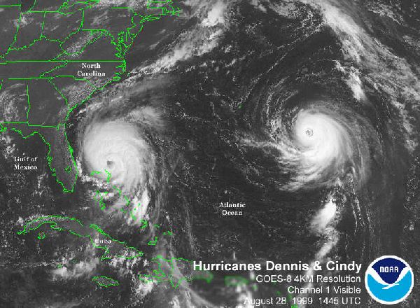
A beautiful picture of simultaneous hurricanes, with Cindy on the right. Formed in August 1999 off the coast of west Africa, Cindy's winds reached 140 mph but no damage was done because the hurricane stayed far from land. Dennis formed in the same month in the north Atlantic, with winds reaching 105 mph. It made landfall in North Carolina causing 43 million US dollars worth of flood damage.
The picture was taken by United States satellite GOES-8 from a height of 20,000 miles above the Americas. GOES-8 (Geostationary Operational Environment Satellite) was launched in 1994. The satellite is a cube, 2 metres on each side, with a solar panel "wing" for power.
This direct quote from the GOES Manual is technical but it does show that the satellite has lots of different functions:
"The main mission is carried out by the primary instruments, the Imager [used to take the picture below] and the Sounder. The imager is a multichannel instrument that senses radiant energy and reflected solar energy from the Earth's surface and atmosphere. The Sounder provides data to determine the vertical temperature and moisture profile of the atmosphere, surface and cloud top temperatures, and ozone distribution.
Other instruments on board the spacecraft are a search and rescue transponder, a data collection and relay system for ground-based data platforms, and a space environment monitor. The latter consists of a magnetometer, an X-ray sensor, a high energy proton and alpha detector, and an energetic particles sensor. All are used for monitoring the near-Earth space environment or solar "weather.".