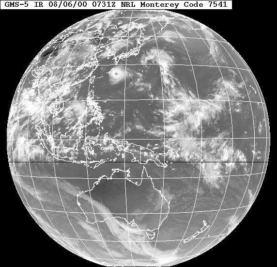
Typhoon Jelawat seen south of Japan. Formed in August 2000 in the western Pacific, Jelawat's winds reached 114 mph.
For orientation, Australia and New Zealand are outlined at the bottom of the globe. The entire right hand half of the view is the Pacific Ocean.
This picture was taken by a Japanese geostationary satellite GMS-5. A geostationary satellite orbits approximately 20,000 miles from the earth's surface, this being the only height where the satellite's time to go around the earth once is exactly equal to the time the earth takes for one rotation. The view seen by the satellite in geostationary orbit is therefore fixed so that it always sees the same geographical area, day and night. This is ideal for making regular observations of cloud patterns over a region or, as here, watching a typhoon track across the ocean.