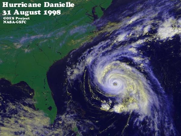
Danielle was a 105 mph north Atlantic hurricane in August of 1998. It briefly threatened the east coast of the USA but broke up at sea. How was the damage potential of Danielle determined (before it reached land)? One way is described below:
THE HURRICANE HUNTERS
A group of pilots called The Hurricane Hunters actually fly directly into the heart of hurricanes! The 53rd Weather Reconnaissance Squadron are part of the United States Air Force Reserve. They fly into the centre of the hurricane to get information on its size, strength and future path. This data is analyzed by the National Hurricane Center which in turn, informs local officials who need to make decisions about possible evacuations of areas that might be at risk.The Hurricane Hunters use WC-130 (Hercules) aircraft on their weather missions. The planes have a six-person crew (aircraft commander, co-pilot, flight engineer, navigator, weather officer and a dropsonde system operator). The dropsonde system operator releases the dropsonde (a weather-sensing canister attached to a small parachute) inside the hurricane. This canister radios back to the aircraft information on the temperature, humidity, pressure and winds inside the storm. The weather information is processed aboard the aircraft and transmitted by satellite to the National Hurricane Center.
The first mission to check a new hurricane is flown at a low altitude, generally between 500 and 1,500 feet. Later, as the storm builds in strength, the flights are at higher altitudes. The planes fly right into the storm - not above it! The ride can get seriously bumpy as the area around the eye is usually surrounded by a solid ring of thunderstorms called the eyewall. Aircraft have come close to being destroyed during these flights.